Happy 2010!
Monday, January 04, 2010


Wednesday, December 30, 2009
Wednesday, December 16, 2009
Wednesday, November 11, 2009
2010 trip
Looks like we might be going to Killarney instead of Algonquin next year. We have the whole winter to contemplate!
Tuesday, August 18, 2009
Missing!
Here are some of the areas of the Park that I have not been to (and would like to).
Any comments would be appreciated.
Access point #1 - North tea Lake area
Access point #29 - Kiosk
Access point #25 - Wendigo (maybe next year?)
Mostly we are missing these because of the longer trip north.
Any comments would be appreciated.
Access point #1 - North tea Lake area
Access point #29 - Kiosk
Access point #25 - Wendigo (maybe next year?)
Mostly we are missing these because of the longer trip north.
Monday, August 17, 2009
Updated - We are up to 93 total!
Algonquin Lakes and Rivers I have visited
Camped On
1. Barron River – Campsite on river, no good swimming, some good fishing. Close to exit at squirrel rapids
2. Big Crow Lake – Good beach
3. Big Porcupine Lake (3 different years – same site) Best site we have ever been on. The westernmost site on big pork
4. Booth Lake - Got hit by lightning here
5. Crotch Lake – 5 nights on a nice campsite – great beach
6. Daisy Lake – on the way to White Trout Lake, quick stop
7. Dickson Lake – Right at the Dickson / Bonfield portage – terrible site
8. Dividing Lake – Nice site, tough portage to get there
9. Farm Lake – on the way to Booth Lake
10. Grand Lake – First stop out of Achray on the way to Opalescent, moderate site
11. Kingscote Lake – very bad site, on the way to Scorch. See trip log algonquinadventures.com
12. Lavieille Lake – at the entrance to the Lake from Crow bay – one of the best sites we have been on
13. Little Trout Lake – nice site – nice lake
14. McManus Lake – Nice sight just after the swift from Smith lake
15. Misty Lake – on the way to White Trout Lake
16. Opalescent Lake – good site, big snapping turtle kept us from swimming. Site is right on the portage.
17. Opeongo Lake – (2 sites) North Arm and East Arm
18. Oxtounge River (2 sites) – High falls site is very good, room for a dozen tents and a fabulous waterfall
19. Park Lake – worst site possible, in view of traffic on hwy 60, exposed, confined, do not go here!
20. Pen Lake – nice lake, lots of good sites and one great one that we haven’t been able to get on
21. Petawawa River – 2 sites – at the chute and schooner rapids (at the hydro line)
22. Rockaway Lake – best fishing ever! Not in the park, on the way to Dividing
23. Scorch Lake – take the trail UP to the best view in the park
24. St Andrews Lake – on the way to Opalescent
25. Sunbeam Lake – Very good island site (easternmost), very nice Lake
26. Timberwolf Lake – on the way out from White Trout, quick stop in bad weather
27. Tom Thomson Lake (2 sites) – great Lake, site on island has great cliff jumping
28. Travers Lake – Last site before hitting rapids
29. Welcome Lake – very pretty Lake with huge SAND beaches, well worth the trip.
30. White Trout Lake – nice site, next to the farm on the map
31. York River – at high falls, no thunder box, lots of people with pop and chips, but still nice
Traversed
1. Aster Pond
2. Bartlett Lake
3. Bear Lake
4. Big Rock Lake
5. Bonfield Lake
6. Brigham Lake
7. Byers Lake
8. Canoe Lake
9. Coveo Lake
10. Cradle Lake
11. Crow Bay
12. Crow River
13. Dagger Lake
14. Fawn Lake
15. Galipo River
16. Godda Lake
17. Grand Lake
18. Grassy Bay
19. Hambone Lake
20. Hardy Bay
21. High Falls Lake
22. High Falls Pond
23. Joe Lake
24. Kimball Lake
25. Kitty Lake
26. Little Crow Lake
27. Littledoe Lake
28. Livingstone Lake
29. Magnetawan Lake
30. McCarthy Creek
31. McIntosh Creek
32. McIntosh Lake
33. Minkey Lake
34. Mole Lake
35. Ooze Lake
36. Oram Lake
37. Proulx Lake
38. Queer Lake
39. Ragged Lake
40. Ralph Bice Lake (Butt Lake)
41. Rock Lake
42. Rumley Lake
43. Ryegrass Lake
44. Shall Lake
45. Smoke Lake
46. Smith Lake
47. Stratton Lake
48. Tattler Lake
49. Tepee Lake
50. Whitson Lake
51. Willow Lake
52. Wright Lake
Visited
1. Bonnechere Lake
2. Branch Lake
3. Cork Lake
4. Depot Lake
5. Harry Lake
6. Hollow River
7. Opeongo River
8. Shirley Lake
9. Snow Lake
10. Tim River
>
Camped On
1. Barron River – Campsite on river, no good swimming, some good fishing. Close to exit at squirrel rapids
2. Big Crow Lake – Good beach
3. Big Porcupine Lake (3 different years – same site) Best site we have ever been on. The westernmost site on big pork
4. Booth Lake - Got hit by lightning here
5. Crotch Lake – 5 nights on a nice campsite – great beach
6. Daisy Lake – on the way to White Trout Lake, quick stop
7. Dickson Lake – Right at the Dickson / Bonfield portage – terrible site
8. Dividing Lake – Nice site, tough portage to get there
9. Farm Lake – on the way to Booth Lake
10. Grand Lake – First stop out of Achray on the way to Opalescent, moderate site
11. Kingscote Lake – very bad site, on the way to Scorch. See trip log algonquinadventures.com
12. Lavieille Lake – at the entrance to the Lake from Crow bay – one of the best sites we have been on
13. Little Trout Lake – nice site – nice lake
14. McManus Lake – Nice sight just after the swift from Smith lake
15. Misty Lake – on the way to White Trout Lake
16. Opalescent Lake – good site, big snapping turtle kept us from swimming. Site is right on the portage.
17. Opeongo Lake – (2 sites) North Arm and East Arm
18. Oxtounge River (2 sites) – High falls site is very good, room for a dozen tents and a fabulous waterfall
19. Park Lake – worst site possible, in view of traffic on hwy 60, exposed, confined, do not go here!
20. Pen Lake – nice lake, lots of good sites and one great one that we haven’t been able to get on
21. Petawawa River – 2 sites – at the chute and schooner rapids (at the hydro line)
22. Rockaway Lake – best fishing ever! Not in the park, on the way to Dividing
23. Scorch Lake – take the trail UP to the best view in the park
24. St Andrews Lake – on the way to Opalescent
25. Sunbeam Lake – Very good island site (easternmost), very nice Lake
26. Timberwolf Lake – on the way out from White Trout, quick stop in bad weather
27. Tom Thomson Lake (2 sites) – great Lake, site on island has great cliff jumping
28. Travers Lake – Last site before hitting rapids
29. Welcome Lake – very pretty Lake with huge SAND beaches, well worth the trip.
30. White Trout Lake – nice site, next to the farm on the map
31. York River – at high falls, no thunder box, lots of people with pop and chips, but still nice
Traversed
1. Aster Pond
2. Bartlett Lake
3. Bear Lake
4. Big Rock Lake
5. Bonfield Lake
6. Brigham Lake
7. Byers Lake
8. Canoe Lake
9. Coveo Lake
10. Cradle Lake
11. Crow Bay
12. Crow River
13. Dagger Lake
14. Fawn Lake
15. Galipo River
16. Godda Lake
17. Grand Lake
18. Grassy Bay
19. Hambone Lake
20. Hardy Bay
21. High Falls Lake
22. High Falls Pond
23. Joe Lake
24. Kimball Lake
25. Kitty Lake
26. Little Crow Lake
27. Littledoe Lake
28. Livingstone Lake
29. Magnetawan Lake
30. McCarthy Creek
31. McIntosh Creek
32. McIntosh Lake
33. Minkey Lake
34. Mole Lake
35. Ooze Lake
36. Oram Lake
37. Proulx Lake
38. Queer Lake
39. Ragged Lake
40. Ralph Bice Lake (Butt Lake)
41. Rock Lake
42. Rumley Lake
43. Ryegrass Lake
44. Shall Lake
45. Smoke Lake
46. Smith Lake
47. Stratton Lake
48. Tattler Lake
49. Tepee Lake
50. Whitson Lake
51. Willow Lake
52. Wright Lake
Visited
1. Bonnechere Lake
2. Branch Lake
3. Cork Lake
4. Depot Lake
5. Harry Lake
6. Hollow River
7. Opeongo River
8. Shirley Lake
9. Snow Lake
10. Tim River
>
Saturday, August 15, 2009
Algonquin Trip August 2009
Opeongo - Big Crow - Lavieille - Dickson - Opeongo
Opeongo - Big Crow - Lavieille - Dickson - Opeongo
Day One
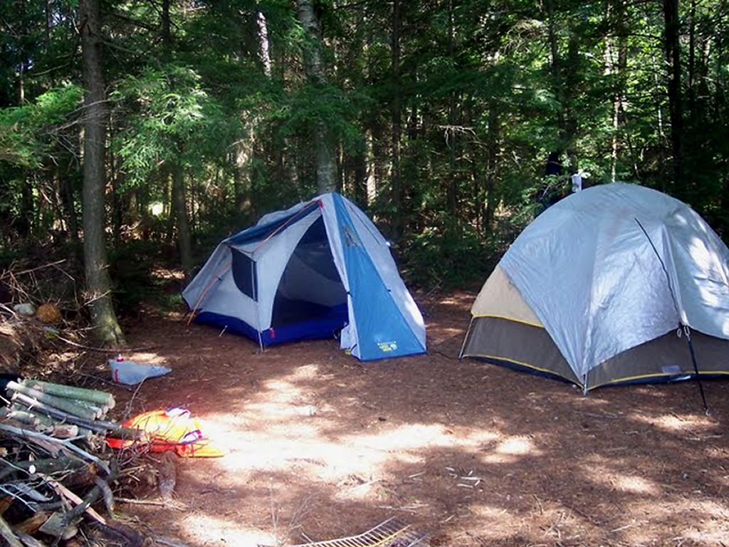
There were 8 of us in the group this year. 5 from my home town of Sarnia, one from Granton and two from Stouffville. We all headed up to the Opeongo access to get our Water Taxi at 1:30 p.m. Permits were obtained, canoes were rented (Algonquin Outfitters) and we were off! We were able to leave about 15 minutes early. Our first night was going to be on the north arm, so we just had the taxi do a quick search for an open campsite. It was busy and after checking the many site on the north shore, we ended up with a dark site on a point close to the Proulx portage that we would be taking tomorrow. It had a very poor take-out but we found it had plenty of tent space once we got into it. We played a couple of poker games, had some great hamburgers and had a drink to another Algonquin adventure!

Opeongo North Arm campsite location.

The take-out at our camp on the North Arm.
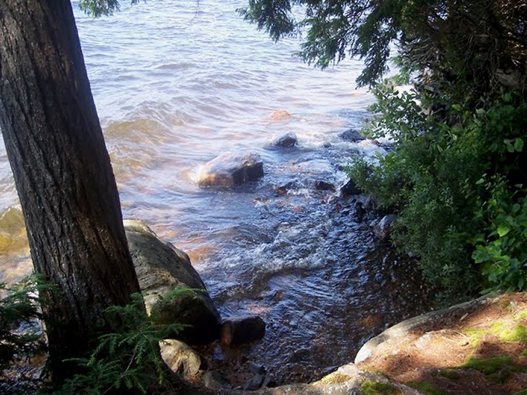

View of our North Arm site from the fire pit.
Day Two
We took the short paddle to the portage and proceeded to carry over to Proulx Lake. The portage was fairly flat except for a hill to get round the small unnamed lake in the middle of the portage. My son and I actually missed the cut off around this lake so we actually did the short paddle! It was only maybe 300m and very buggy!
We were disappointed that we didn't see any moose at all on the Crow River. The paddle was nice however, and we made good time getting through Little Crow Lake into Big Crow. We had 4 canoes so we sent out some scouting parties to look for the best site. One pair went to the Ranger Cabin and got us 20 liters of water from the spring there. There is a good site to the south of the cabin on the opposite side of the lake but we settled for the Northern beach site. All three of the sites north of the Crow River are connected by a trail. We met both of our neighboring parties, one from Kingston and the other from Baltimore.
The site is quite nice, with a "kitchen" shelf and some benches. We didn't want to paddle into the wind to go back to the fire tower, so we hunkered down and spent the afternoon and evening playing cards and enjoying a penne and sausage dinner.

Day Two Campsite location.

Big Crow Lake beach.

Day Three (and Four)
We knew this was going to be a tough day. We started the trek down the Crow River, towards Lake Lavieille and were prepared (we thought) for the multiple portages. There was nothing particularly challenging about any of the portages. There were just lots of them, with winding river-paddling in between. We also had thunderstorms chasing all around us all day, but we managed to come out unscathed.
The put-ins and take-outs are all what you would expect on a river .. rocky and uneven. You also get a little sick of the "in-the-canoe / out-of-the-canoe" routine near the end of the river. We were all quite tired by the time we reached Crow Bay. And there was still a good paddle ahead to get to Lavieille. Water levels were quite high. If they had been lower, this trip would have taken much longer. For us it was about 6 hours.
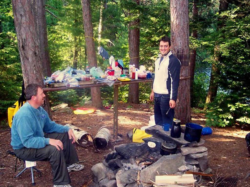
When we reached the group of campsites at Lavieille, the first one did not look great and the 2 on the north of the opening were taken. So we went to the site on the south point. What a great campsite! It had plenty of roaming space with good tent sites, rock porches on the east side to face Lavieille and the west side facing Crow Bay. And, it had a great fire pit area with a shelf. The view of Lavieille to the east was spectacular. Very pretty! This would be our stop for two nights, so we were glad we had a good site.
We only caught one spec and had it for a snack. Basically, this was our chance to just kick back in the wilderness.

3rd and 4th nights' campsite.

One fish! That's it?.

View from the Lavieille campsite.

Lavieille fire pit.
Day Five
It was a 15 k paddle today down the length of Lavielle to Dickson. The morning was beautiful and we had flat water to start. It was hard to leave such a pretty lake, one of my favorite spots that I have been to in the park.
We wanted to get as close as possible to the start of the Dickson / Bonfield portage, that we would start the next morning. As we arrived at the inlet that leads to the portage, we passed a campsite that was perfect. But some in the group wanted to look at the site that was located right at the start of the portage. If I was to do this again, I would stay at the site that we passed. But the group majority decided to stay on the portage site. It was pretty basic. I think it is designed more as an emergency site for someone coming out of the long portage too late in the day to venture into the Lake.
We decided to carry the canoes (3 of the 4) down the portage to lighten the load for the next day. I would not do this again either as it is a long walk. It took six of us carrying the 3 alternately. With the ultra light canoes it was an easy carry but, as mentioned, it's a long way! The walk back seemed to take forever and I don't like the feeling of walking back along an entire portage. I would have preferred to take everything at the same time with frequents breaks, but doing it only once. When you travel with a larger group I guess you have to go with the majority! We took about three hours to take the canoes to the end and walk back. That's 10,600 meters of walking. The trail is in great shape with only a few sections that are rocky. There are lots of boardwalks built over the difficult sections. The only real challenge is the length!
Then the rain came. It started just as I was cooking dinner and made things difficult. We set up a tarp but eventually just headed for the tents. I was laying down at about 7:30 p.m. and eventually just went to sleep. My son and I ended up spending about 11 hours in the tent! (well it is a vacation! Lol) The rain was on and off all night but no thunderstorms came. Unfortunately I don't have pictures of this site because of all the wet weather.

5th night campsite.
Day Six
Today was the day we took the rest of our possessions across the Dickson / Bonfield portage. One advantage to walking the portage the day before was the awareness of how long it would take and the various "markers" along the way. We were using Jeffrey's map as a reference. The map did not reflect what we felt were the true distances between these markers. This may be due to other circumstances (like the terrain - or how tired we were) but we felt that the cart trail cut off was about ¼ of the way down the trail and the road was about ¾ of the total. The map shows it quite different. I don't know if anything has changed or not? We finished the portage in about 90 minutes.

Near the start of the Dickson / Bonfield.

Almost to Bonfield Lake.

Dickson / Bonfield completed!.
We then paddled and portaged through Bonfield and Wright's Lake to get to Opeongo. Nice little lakes. One of our canoes stopped to fish in Bonfield and caught a bass. When we arrived at Opeongo we saw that there were numerous campsites right at the end of the portage extending north to the end of the cart trail. This whole area is very open with abundant tall pines all around. We went to the 2nd site south of the cart trail exit. It was a fantastic site with a great beach but had the potential for many very close neighbors during busy times.
Unfortunately, the previous campers had left the site in quite a mess, with strewn garbage and a fire pit full of old food and containers. It's hard to explain some people actions. We even saw live trees with large hatchet gashes in them. Also, the Dickson memorial that was close by has been vandalized. The plaque is missing and many of the rocks have been pulled away.
We had a great last evening in Algonquin and enjoyed a KD dinner and a wee bit of Scotch. The water taxi was coming tomorrow at 8:30 a.m. to pick us up.

What was left in the fire pit for us.

The beach at our East Arm site.
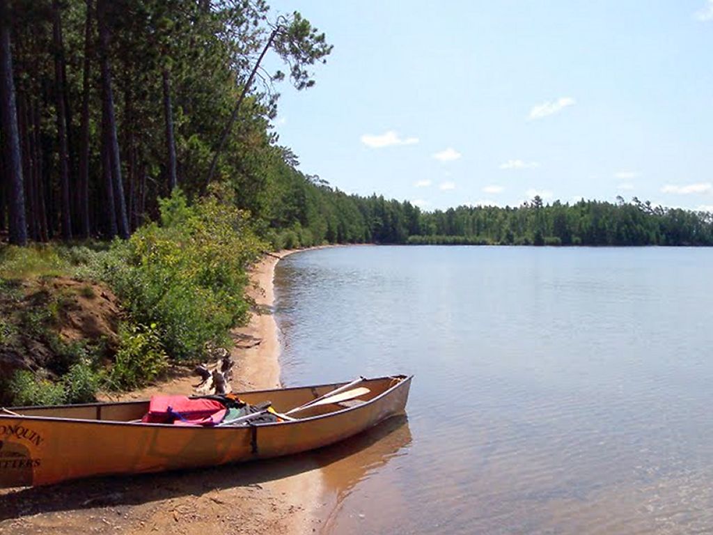

Opeongo East Arm campsite.
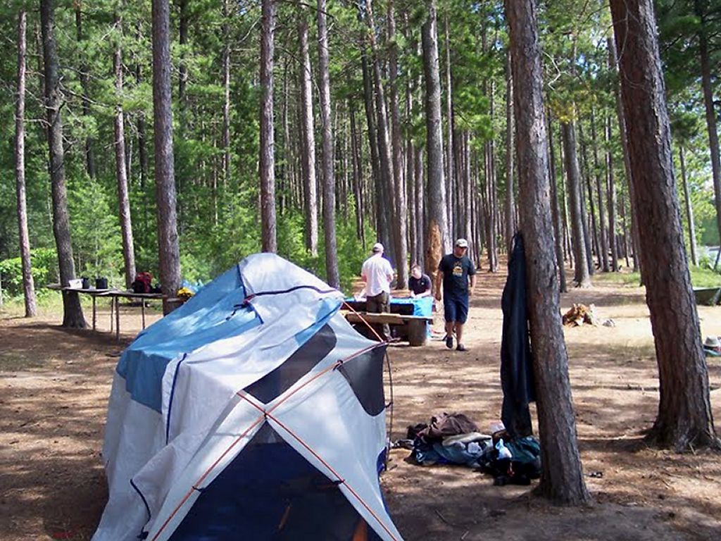

6th night's campsite.
Day Seven
The water taxi was early and arrived at the East Arm at about 8:05. He was scheduled to pick us up at the portage but spotted us right away at our site and got us there. We were on the way at 8:20 for a cold, quick rise back to the access point. All that remained now was a hot shower, a change of clothes and a 6 hour car ride back to Sarnia.
Another successful Algonquin Adventure!
Need more info? Email me at : freedom55@gmail.com
All of the pictures (and videos) are at : http://picasaweb.google.com/freedom55/Algonquin2009?authkey=Gv1sRgCIDej_3UssqF5gE&feat=directlink
Sunday, August 09, 2009
Friday, July 31, 2009
Wednesday, July 22, 2009
Monday, July 13, 2009
TRIP PREP
- Beef jerky is all made.
- Maps are done (laminated from Jeffry's maps)
- Getting the gear ready
- Menus planned
- Food shopping soon!
Saturday, June 06, 2009
The 2009 trip is BOOKED!
Here is the route for our trip this year
Finally we take on the Dickson / Bonfield!
Sunday August 2nd.
Water taxi (Algonquin Outfitters) is dropping us off at our first days campsite so there will be no paddling or portaging this day.
Monday August 3rd.
We will take a 1390 portage to Proulx Lake and then paddle north through Little Crow Lake to Big Crow Lake, camping there for the night.
Tuesday August 4th
We travel down the Crow River heading towards Lake Lavielle. There are typical river portages (around rapids) of 240, 155, 1220, 385, 170, 205 and 110.We will camp on lake Lavielle for the night.
Wednesday August 5th
No portages. We paddle south to Dickson Lake. We need to find a camp that is good for two nights stay.
Thursday August 6th
Another day on Dickson lake.
Friday August 7th
The Famous Dickson - Bonfield Portage! 5305 meter. Plus a 260 and a 285 takes us out to Opeongo where we will camp for our last night.
Saturday August 8th
The water Taxi will pick us up at 8:30 a.m. We need to be at the portage exit area at that time!
Looking forward to August!
Finally we take on the Dickson / Bonfield!
Sunday August 2nd.
Water taxi (Algonquin Outfitters) is dropping us off at our first days campsite so there will be no paddling or portaging this day.
Monday August 3rd.
We will take a 1390 portage to Proulx Lake and then paddle north through Little Crow Lake to Big Crow Lake, camping there for the night.
Tuesday August 4th
We travel down the Crow River heading towards Lake Lavielle. There are typical river portages (around rapids) of 240, 155, 1220, 385, 170, 205 and 110.We will camp on lake Lavielle for the night.
Wednesday August 5th
No portages. We paddle south to Dickson Lake. We need to find a camp that is good for two nights stay.
Thursday August 6th
Another day on Dickson lake.
Friday August 7th
The Famous Dickson - Bonfield Portage! 5305 meter. Plus a 260 and a 285 takes us out to Opeongo where we will camp for our last night.
Saturday August 8th
The water Taxi will pick us up at 8:30 a.m. We need to be at the portage exit area at that time!
Looking forward to August!
Sunday, August 10, 2008
Tom Yates
Travers to McManus on the Petawawa – August 2008
Friday August 1st
We drove from Sarnia Ontario, leaving at about noon and arriving at Algonquin Portage at about 9 p.m... We had booked accommodations with Algonquin Portage previously ($27 per person) as well as breakfast the next morning ($8.00). The rooms were waiting for us as advertised, and we had a game of cards on the front porch before we turned in. The rooms were great and well looked after. There are plenty of showers also!

Saturday August 2nd
We woke up to rain pouring down on us and waited till our breakfast was prepared. They open at 8 a.m... After breakfast we got our canoes and loaded them onto our two vehicles. We also met Markus and Joan in the store!
We had arranged for Algonquin Portage to transfer our vehicles during the week back to McManus for us. The road to Travers is well looked after and we made good time getting to the put in. By the time we headed out into the lake the rain had stopped and the weather was quit nice.
Our goal was to get as far up the lake as we could so that the next day we would be close to Big Thompson rapids. We scouted sites along the way had 8 people in the group so we needed a good amount of flat space if possible. We used FRS radios to talk to each other about the sites and hop scotched along the shore.
We arrived at our final destination, the last site on the lake, and set up camp at about 1 p.m. or so. We had a dinner of hamburgers and played a little poker and looked forward to the journey ahead.
Sunday August 3rd
We had breakfast and broke camp by 9 a.m. and headed out to Big Thompson Rapids. The water level was high because of all the rain this year so we were going to portage both Thompson’s HOWEVER two of our members decided to give it a shot rather than carry. They had portaged the gear already so they were just going in the empty canoe.
The results were less than spectacular as they dumped no less than 10 feet into the rapid and ended up on the far shore. They got in and proceeded to dump again and float down to the rest of us. A humbling experience for sure!

.
We continued on the portage around little Thompson too and headed on to the first rapids we would all run, Grillade. There were some big waves and high bouncing canoes but we all made it through with full canoes. Great fun!
Our destination for the camp was Crooked Chute. There were a few choices of campsites but we want the one at the final takeout if possible.
We had decided to canoe past the first takeout and get out at the second. There is a campsite at the second takeout but it is less than desirable. It looks like it is there for emergency use for late arrivals. We portaged our gear down to the last takeout and saw that our desired camp was available! And what a winner it is. It had plenty of flat tents sites and was right on the raging river. A top notch site in anyone’s book!
We were happy that it was so ideal because we were going to stay an extra day here. We spent the rest of the day getting settled, exploring, and fishing. There was some bass caught so we had enough for one filet each for dinner to go along with our penne noodles.
Monday August 4th
It was a pleasure to not have to get up and pack for the road. We just had a leisurely breakfast and planned a day of exploration and relaxing.
The campsite is right on the portage and we had a couple of groups go through. There is also a shortcut right through the middle of our camp to get to the put in below the chute. We had a group from Wales take that very route.
We walked down the shortcut to the chute itself and watched in awe as the water squeezes through the narrow opening, thanking ourselves that we were not in a canoe going that way!
We also portaged the canoes to the put in area (they had to be there tomorrow anyway!) and explored the Lake area below the chute. There is a beach and a ranger cabin. We swam and explored and I got bit by horse flies (an annual tradition).
Back at camp there was cards (another tradition) and resting in the hammock and afternoon naps and just plain enjoyment. We had fish with our dinner again but just a teasing snack amount! Dinner was noodles n sauce with Italian smokies sausage.
The weather was great here and we even had a chance to see some shooting stars. We did discover that the rock at the campsite has a population of mice living in it. We made the discovery when one of the guys had a mouse crawl OVER HIS FACE while he was lying on the rock LOL!
They were there, but they didn’t really bother us. I recommend this site to anyone going this way!
Tuesday August 5th
We broke camp again at about 9 a.m. and headed out to Rollway rapids. We were definitely portaging here as we are greenhorns at this whitewater stuff. The portage is not too tough and we did it in two stages with the gear going first and the canoes coming on the second trip. We stopped at the Blair Fraser memorial. The cross has been broken off. I can only hope that is was a tree that did it rather than a person. Right below where the memorial is supposed to be there is a broken canoe in the water to remind us that portaging is not so bad.
Next was the Notch Rapids. We decided to carry the gear over first and decide whether to run or not on the way. This portage is horrible! The Petawawa white water guide says that “you have to be a mountain goat to do this portage” and they were not kidding. I think even THEY would avoid this portage!
We decided to run the rapids with empty canoes because no one wanted to carry an 85 pound canoe over that portage! One canoe did get carried however because they did not want to run. Everyone made the run safely except me and my brother in-law Ted. We dumped and proceeded to swim over the falls and float down the river waiting for rescue. All we could think of was that it was still better than carrying that darn canoe over that portage!
After the Natch we had quite a long paddle to get to our desired camp near Schooner rapids, but boy was it a beautiful paddle! The cliffs are fantastic!

Our goal was to stop before Schooner and camp for the night but none of the spots were good so we pressed on into Schooner. Again we did them with full canoes and had lots of fun in big waves and high water. About half way through Schooner there is a little lake (right before the hydro lines) and we still had not found a suitable campsite.
On Jeffrey’s digital map, (which I had with me) there is a site here that is marked on a road. The same site is not marked on the Canoe routes map. We found the site but there was no orange sign. I don’t know if we were breaking any rules but it was getting late and it looked like bad weather was coming so we made camp. What a strange camp it was. It was on a road, just down from a Hydro-One bridge, and the grass (weeds) was high! There WAS a thunderbox in good condition AND a picnic table. If anyone knows the story of this site, let me know.
It started to thunderstorm at about 7:30 p.m. and rain shortly after. We headed to the tents for a long (if restless) night of sleep.
Wednesday August 6th
The rain stopped just as we got up in the morning (About 6 a.m.) and there was least 2 inches of water in the cups left on the table! We got breakfast and got out of there.
Our goal for the day was to complete the rapids (the rest of Schooner and Five Mile Rapids) and then look for a campsite on the lakes.
We had great fun running the rest of the rapids with a few rocks hit but nothing major and everyone right side up. Once we got past all the rapids we started looking for a place to spend our last night. Site after site was either too small (not enough tent spaces) or too weedy and buggy (as river sites tend to be). However as we came through the last swift and into McManus Lake we saw the holy grail of campsites! It’s not on Jeffrey’s map OR my version of the canoe routes map but it was clearly marked with the orange sign.
It had a great flat are on top of a nice hill over looking the lake. I am not exaggerating when I say that at least 10 tents could be set up on this site! And it was beautiful too.
We enjoyed our last day in paradise with a great evening of poker, Kraft dinner, and a wee bit of scotch. We were only 3 k from the take out so tomorrow were going to be easy (except for the 9 hour car ride!!)
Thursday August 7th
Up at 6, off the site by 8 and the takeout before 11. Pick up the cars, take the canoes back and roll on back to Sarnia! Another successful Algonquin Adventure!
All my pictures and videos are here (including the one of me falling out!)
http://picasaweb.google.com/freedom55/Algonquin2008
Questions or comments? Email me at
freedom55@gmail.com
Travers to McManus on the Petawawa – August 2008
Friday August 1st
We drove from Sarnia Ontario, leaving at about noon and arriving at Algonquin Portage at about 9 p.m... We had booked accommodations with Algonquin Portage previously ($27 per person) as well as breakfast the next morning ($8.00). The rooms were waiting for us as advertised, and we had a game of cards on the front porch before we turned in. The rooms were great and well looked after. There are plenty of showers also!
Algonquin Portage Cabin

Saturday August 2nd
We woke up to rain pouring down on us and waited till our breakfast was prepared. They open at 8 a.m... After breakfast we got our canoes and loaded them onto our two vehicles. We also met Markus and Joan in the store!
We had arranged for Algonquin Portage to transfer our vehicles during the week back to McManus for us. The road to Travers is well looked after and we made good time getting to the put in. By the time we headed out into the lake the rain had stopped and the weather was quit nice.
Our goal was to get as far up the lake as we could so that the next day we would be close to Big Thompson rapids. We scouted sites along the way had 8 people in the group so we needed a good amount of flat space if possible. We used FRS radios to talk to each other about the sites and hop scotched along the shore.
We arrived at our final destination, the last site on the lake, and set up camp at about 1 p.m. or so. We had a dinner of hamburgers and played a little poker and looked forward to the journey ahead.
Lake Travers campsite

Sunday August 3rd
We had breakfast and broke camp by 9 a.m. and headed out to Big Thompson Rapids. The water level was high because of all the rain this year so we were going to portage both Thompson’s HOWEVER two of our members decided to give it a shot rather than carry. They had portaged the gear already so they were just going in the empty canoe.
The results were less than spectacular as they dumped no less than 10 feet into the rapid and ended up on the far shore. They got in and proceeded to dump again and float down to the rest of us. A humbling experience for sure!
The Hard way to portage

.
We continued on the portage around little Thompson too and headed on to the first rapids we would all run, Grillade. There were some big waves and high bouncing canoes but we all made it through with full canoes. Great fun!
Our destination for the camp was Crooked Chute. There were a few choices of campsites but we want the one at the final takeout if possible.
We had decided to canoe past the first takeout and get out at the second. There is a campsite at the second takeout but it is less than desirable. It looks like it is there for emergency use for late arrivals. We portaged our gear down to the last takeout and saw that our desired camp was available! And what a winner it is. It had plenty of flat tents sites and was right on the raging river. A top notch site in anyone’s book!
Better get out here!

We were happy that it was so ideal because we were going to stay an extra day here. We spent the rest of the day getting settled, exploring, and fishing. There was some bass caught so we had enough for one filet each for dinner to go along with our penne noodles.
Monday August 4th
It was a pleasure to not have to get up and pack for the road. We just had a leisurely breakfast and planned a day of exploration and relaxing.
The campsite is right on the portage and we had a couple of groups go through. There is also a shortcut right through the middle of our camp to get to the put in below the chute. We had a group from Wales take that very route.
We walked down the shortcut to the chute itself and watched in awe as the water squeezes through the narrow opening, thanking ourselves that we were not in a canoe going that way!
We also portaged the canoes to the put in area (they had to be there tomorrow anyway!) and explored the Lake area below the chute. There is a beach and a ranger cabin. We swam and explored and I got bit by horse flies (an annual tradition).
Back at camp there was cards (another tradition) and resting in the hammock and afternoon naps and just plain enjoyment. We had fish with our dinner again but just a teasing snack amount! Dinner was noodles n sauce with Italian smokies sausage.
The weather was great here and we even had a chance to see some shooting stars. We did discover that the rock at the campsite has a population of mice living in it. We made the discovery when one of the guys had a mouse crawl OVER HIS FACE while he was lying on the rock LOL!
They were there, but they didn’t really bother us. I recommend this site to anyone going this way!
Cooking the noodles at Crooked Chute.

Tuesday August 5th
We broke camp again at about 9 a.m. and headed out to Rollway rapids. We were definitely portaging here as we are greenhorns at this whitewater stuff. The portage is not too tough and we did it in two stages with the gear going first and the canoes coming on the second trip. We stopped at the Blair Fraser memorial. The cross has been broken off. I can only hope that is was a tree that did it rather than a person. Right below where the memorial is supposed to be there is a broken canoe in the water to remind us that portaging is not so bad.
Next was the Notch Rapids. We decided to carry the gear over first and decide whether to run or not on the way. This portage is horrible! The Petawawa white water guide says that “you have to be a mountain goat to do this portage” and they were not kidding. I think even THEY would avoid this portage!
The Natch – Portage

We decided to run the rapids with empty canoes because no one wanted to carry an 85 pound canoe over that portage! One canoe did get carried however because they did not want to run. Everyone made the run safely except me and my brother in-law Ted. We dumped and proceeded to swim over the falls and float down the river waiting for rescue. All we could think of was that it was still better than carrying that darn canoe over that portage!
After the Natch we had quite a long paddle to get to our desired camp near Schooner rapids, but boy was it a beautiful paddle! The cliffs are fantastic!
The Cliffs at the Natch

Our goal was to stop before Schooner and camp for the night but none of the spots were good so we pressed on into Schooner. Again we did them with full canoes and had lots of fun in big waves and high water. About half way through Schooner there is a little lake (right before the hydro lines) and we still had not found a suitable campsite.
On Jeffrey’s digital map, (which I had with me) there is a site here that is marked on a road. The same site is not marked on the Canoe routes map. We found the site but there was no orange sign. I don’t know if we were breaking any rules but it was getting late and it looked like bad weather was coming so we made camp. What a strange camp it was. It was on a road, just down from a Hydro-One bridge, and the grass (weeds) was high! There WAS a thunderbox in good condition AND a picnic table. If anyone knows the story of this site, let me know.
It started to thunderstorm at about 7:30 p.m. and rain shortly after. We headed to the tents for a long (if restless) night of sleep.
The Hydro-One site

Wednesday August 6th
The rain stopped just as we got up in the morning (About 6 a.m.) and there was least 2 inches of water in the cups left on the table! We got breakfast and got out of there.
Our goal for the day was to complete the rapids (the rest of Schooner and Five Mile Rapids) and then look for a campsite on the lakes.
We had great fun running the rest of the rapids with a few rocks hit but nothing major and everyone right side up. Once we got past all the rapids we started looking for a place to spend our last night. Site after site was either too small (not enough tent spaces) or too weedy and buggy (as river sites tend to be). However as we came through the last swift and into McManus Lake we saw the holy grail of campsites! It’s not on Jeffrey’s map OR my version of the canoe routes map but it was clearly marked with the orange sign.
It had a great flat are on top of a nice hill over looking the lake. I am not exaggerating when I say that at least 10 tents could be set up on this site! And it was beautiful too.
McManus Lake Campsite

View of McManus Lake from our site

We enjoyed our last day in paradise with a great evening of poker, Kraft dinner, and a wee bit of scotch. We were only 3 k from the take out so tomorrow were going to be easy (except for the 9 hour car ride!!)
The Last Evening

Thursday August 7th
Up at 6, off the site by 8 and the takeout before 11. Pick up the cars, take the canoes back and roll on back to Sarnia! Another successful Algonquin Adventure!
All my pictures and videos are here (including the one of me falling out!)
http://picasaweb.google.com/freedom55/Algonquin2008
Questions or comments? Email me at
freedom55@gmail.com
Saturday, August 09, 2008
Friday, August 08, 2008
2008 Trip - Just Back
WE just arrived back from the trip and I will post a trip log and pictures very soon.
Tuesday, May 13, 2008
Sunday, February 24, 2008
FROM markinthepark.com
Vintage Algonquin Park Maps
This section provides links to vintage Algonquin Park maps, that are deemed public domain under Section 12 of the Canadian Copyright Act. Many Thanks goes out to Jeffrey McMurtrie for loaning out the map. Scanning and subsequent image processing by Mark Rubino. Maps posted here are freely available to everyone. Please feel free to mirror any maps, to help reduce the load on the server hosting markinthepark.com.
1946 Algonquin Park Area Map - Chief Geographer's Office, Surveys and Engineering Division 1946

JPEG - 8.74MB Download
This section provides links to vintage Algonquin Park maps, that are deemed public domain under Section 12 of the Canadian Copyright Act. Many Thanks goes out to Jeffrey McMurtrie for loaning out the map. Scanning and subsequent image processing by Mark Rubino. Maps posted here are freely available to everyone. Please feel free to mirror any maps, to help reduce the load on the server hosting markinthepark.com.
1946 Algonquin Park Area Map - Chief Geographer's Office, Surveys and Engineering Division 1946
JPEG - 8.74MB Download
Friday, February 15, 2008
New tent
I Purchased a new tent today! Can't wait to use it
Lightpath 3Easy to pitch with a dry entry design, the Lightpath goes up quick, even in nasty weather. Plenty of room for three, but luxurious for two people (and Spot). A well designed floor plan keeps weight down, and roomy vestibule leaves plenty of space to store gear under cover. Guaranteed watertight construction. Superlight option: pitch with fly only plus and Pitch Light™ footprint to shave pounds. Footprint sold separately.
| |  |


| |
| |||||||||||||||||||||||||||||||||||||||||||||||||||||||||||||||||||||||||||||||||||||||||||||||

 VIEW ADDITIONAL SPECIFICATIONS
 HIDE ADDITIONAL SPECIFICATIONS


Subscribe to:
Posts (Atom)